Mount Canoblas the centre of a drainage catchment I visited and videoed in 2010 and pointed out the problems that would eventually result in a disastrous flood in 2022
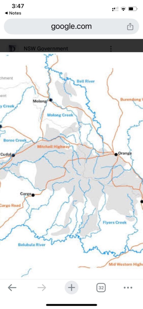
Mount Canobolas is the centre of all the streams radiating out from this map. Mount Canobolas volcanic soils a very porous and surface water is collected underground in the fractured rock aquifers covering this entire area.
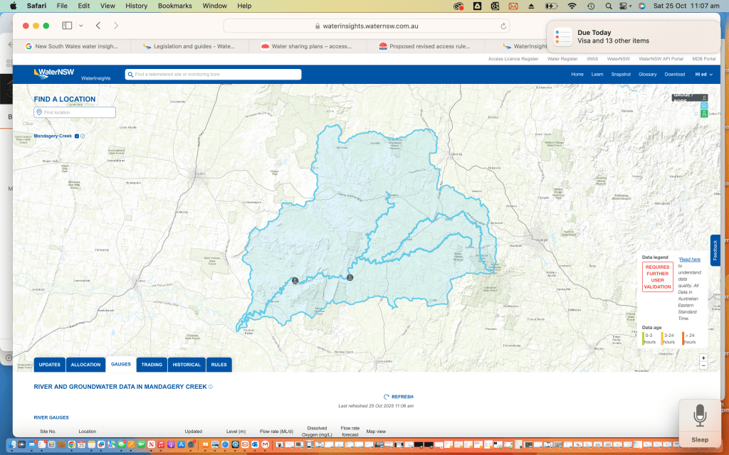
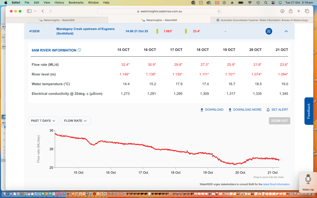
The blue shaded area on this map which is the Mandagery Creek catchment contains some of those streams radiating out from Mount Canobolas potentially carrying water right to the Lachlan River below Eugowra
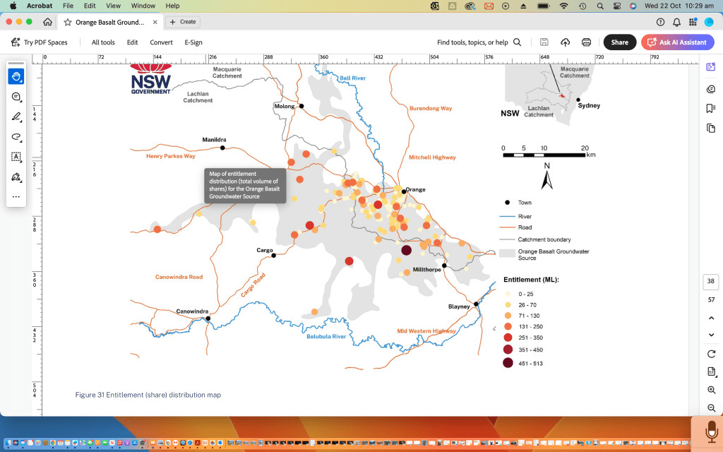
Map of entitlement distribution (total volume of shares) for the orange basalt ground water source.
This water source is adjacent to the Mandagery Creek water source.
I wrote the following poem. I videoed the above video. Recorded the above audio all in 2010. Pointing out the problems of overuse of our vital ecsystems 15 years ago.

 Google earth doesn't lie

It's shows the earth from the sky
.
 The Upper Lachlan catchment isn't flat

 we can be sure of that.

What I see. No tree,

only water carved wrinkles
.
Free to carve deeper

. Run water run and scour.

It's a joke that you can no more soak

Look, look down at the manhandled Mandagery


It's a shame.

It's just a drain.

To speed the rain.

 Sudden storm like an express train

. Winds it's way to a salty end on the Lachlan plain.

We've got the brains to slow the rains
.
 And there are some good souls go to pains

. As a bystander I am shocked

  by the stocks impact.

Piecemeal it won't heal.

How much floggen and delog'n
.
How much pug'n and bog'n.

Join together.

 Make a chain to restrain the flow
.
 A chain of land owners to recreate the chain of ponds

. A chain of resistance to stock
.
  A virtual lock on vulnerable land.

 Collar the cattle.

Shock the stock of that block.

Give them some other till it can recover

. GPS not only a factor in steering ya tractor

. Steers the stock.

 They yield to a virtual field.
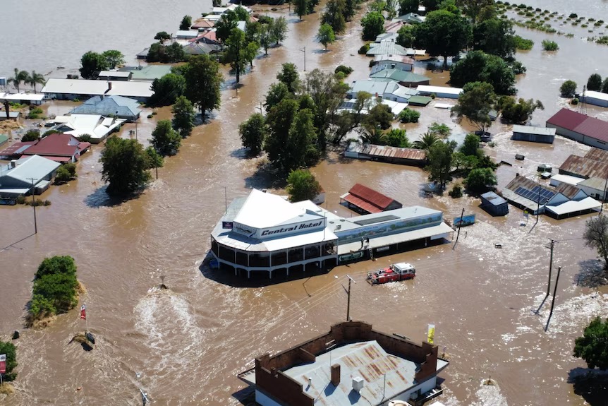
- photo curtesy ABC news.
- Eugowra. Main Street during the 2022 floods.
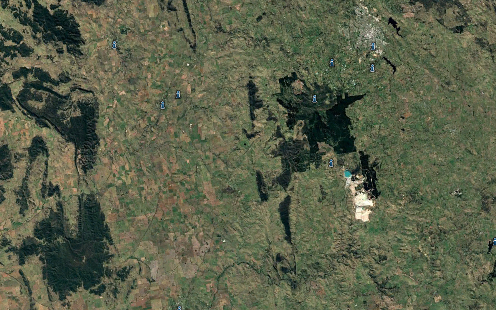
look at the monitor bores around Mount Canobolas groundwater catchment
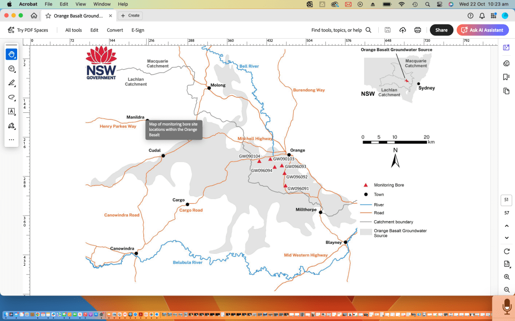
Look at the extent of the catchment called Mount Canobolas groundwater

All of the lachlan catchment surface water sources

Extraction rates from bores around Mount Canobolas ground water source
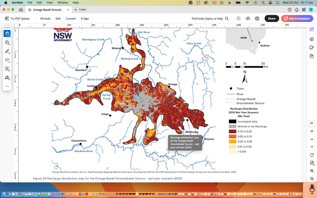
Recharge of Canobolas ground water sources in good years

Recharge of Canobolas ground water sources in poor years
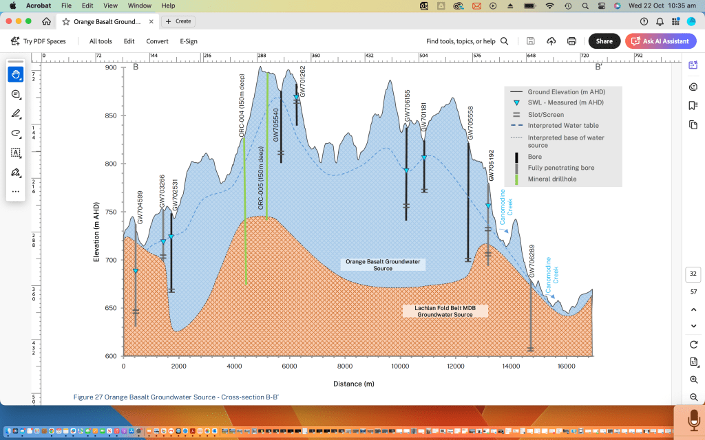
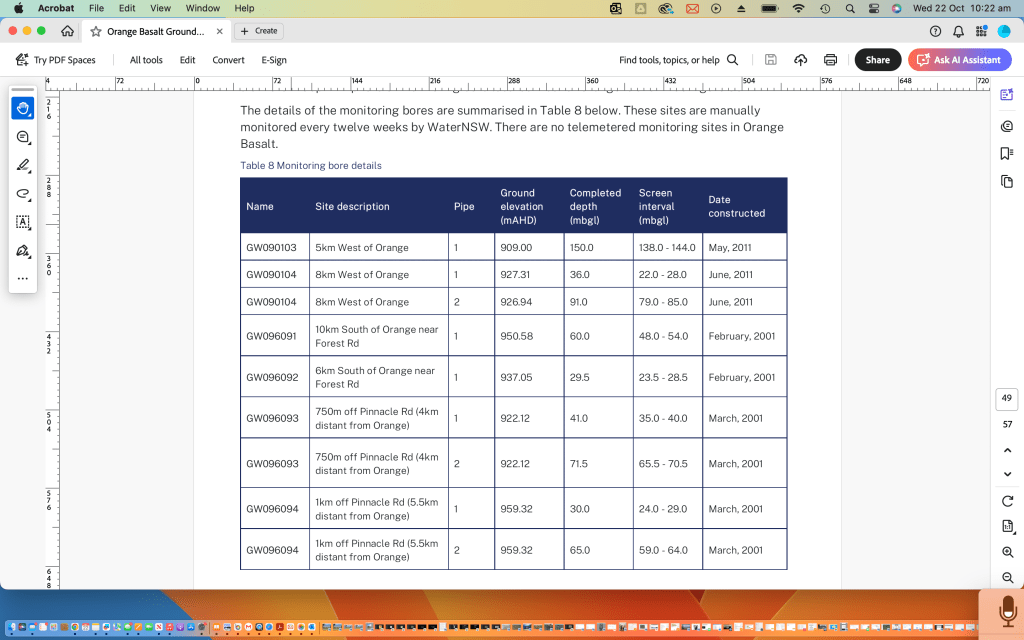
Bores in the Canobolas ground water source and also the Lachlan fold belt fractured rock water source
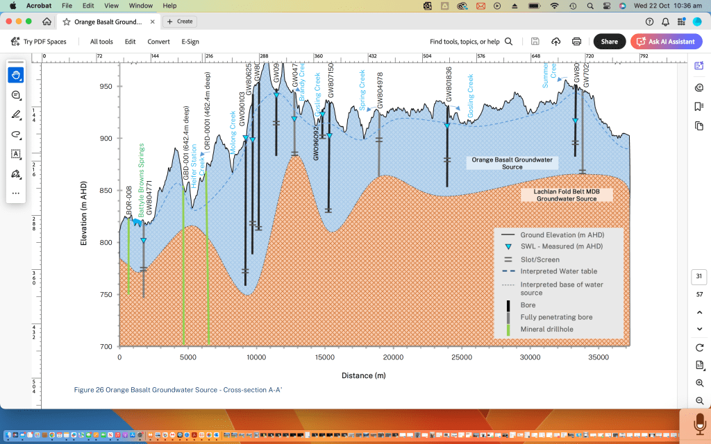
More bores in the Canobolas groundwater source
I acknowledge that use of data from Google Earth and the New South Wales government websites
Eddie Vagg 703 River Road Lake Cargelligo
